Petition updateSTOP THE BAHIA MAR FIASCO AND THE WAVE TROLLEY FOLLYTHE “DENSITY” OF DEVELOPERS AND POLITICIANS

Citizens Against Bahia Mar Fiasco
Nov 1, 2017
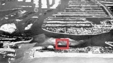
Bahia Mar was created in 1949 from what was, for centuries, an unstable, shifting sandbar in a lagoon or bay behind the barrier island next to the inlet. In the 1600’s Ponce de Leon named the river flowing out the inlet, Rio Nuevo, because storms were constantly shifting its location connecting the Bay to the Sea.
The area, known today as Bahia Mar, was federal “property” dating back to the Seminole War in the 1840s when Major Lauderdale built a Fort on the bay side of the beach behind the dunes.
When the City of Fort Lauderdale purchased Bahia Mar from the Federal Government it consisted of:
Total area:: 1,683,574 sq ft = 38.65 acres
“Upland”: 695,430 sq ft = 15.96 acres (euphemism for the area filled with sand dredged from the lagoon and inlet).
“Submerged Land”: 988,144 sq ft = 22..69 acres (the marina).
Under the Sec 47-12.5 SBMHA, the maximum “density” requirement for Bahia Mar is 48 units/acre.
This arbitrary number has become sacred, even though the urban planning concept of thus “density” measure has no relevance whatsoever to a former sandbar.
The Developer proposes:
1. 651 residential units.
2. 250 hotel suites
3. Approximately 200 existing Yacht slips
4. Approximately 2,600 mostly “underground” parking garage spaces (actually below sea level).
5. 151,000 square feet of commercial space (shops, restaurants, supermarket and offices).
The Leaseholder/Developer uses the total area size (“upland” plus “submerged”) to divide by 651 apartments to yield 16.84 units per acre. (The Developer uses this traditional urban planning concept of “density” to justify the “reasonableness” of its plan to build a small city on former sandbar).
Using only the 15.96 “upland” acres and 651 apartments, the “density” equals 40.7 units per acre which the Developers brag is also less than zoning’s maximum requirement of 48 units per acre.
But “density”, in reality, is created by more than the 651 apartments.
First, realize that the approximately 200 yachts in the marina are dynamic “residential living units” just as much or more so than apartments. Each yacht accommodates the crew as well as its owners and guests. When not used for its leisure purpose, a Yacht is being cleaned, serviced, repaired and provisioned which involves multiple personnel and vehicles at any given time. This activity uses and occupies and creates “density” on the “upland” area as well as the “submerged” area.
The same applies to the hotel suites, not to mention the 151,000 square feet of restaurant and other commercial space.
The idea that the Developer is only using a “density” measure of 40.7 units per acre is LUDICROUS!
In reality, the measure of “density” per acre should include the number of yachts, hotel suites, people and vehicles, as well as the physical spaces that will be occupying this glorified sandbar.
The true “density” is more like 330 units per acre. More like Manhattan than a beach resort!
Also, consider the use of this urban concept of “density” for a site that has water on three sides a few hundred feet from the Atlantic’s waves crashing on the beach..
Consider that almost all traffic egress and ingress moves through a narrow funnel connecting the site to A1A (which is another funnel connecting the barrier island to the Mainland.
The traditional measure of “density” used for this site, in reality, is an unsustainable development concept. The conventional zoning measure of “density” is just one abstract and arbitrary dimension of the real concept of “density”. Traffic flow and mobility, given a single source of access to the area, the extreme physical, safety and security needs of a working marina, movement around and through a recreational space, the ebb and flow of commercial activity, service workers’ management of the overall facility and the need for space and flow during medical, fire and storm related emergencies, render this concept a Fiasco in the making.
It should be the responsibility of the Leaseholder/Developer to prove the feasibility of their proposal. It should not be the responsibility of the Citizens to prove that the proposal is NOT feasible!
This is Public Land. If the Leaseholder/Developer is wrong, the Pubic, who bears the risk, will pay the price. A huge price. The Leaseholder/Developer will pay nothing.
Support now
Sign this petition
Copy link
WhatsApp
Facebook
Nextdoor
Email
X