
Open the Gates: Save Reno's Riverwalk, Restore Bike Route 2 & Stop the Trail Destruction!
The Issue
To: The Reno City Council, Mayor Hillary Schieve, Reno City Attorney Karl Hall, and the Truckee River Flood Management Authority (TRFMA)
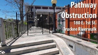
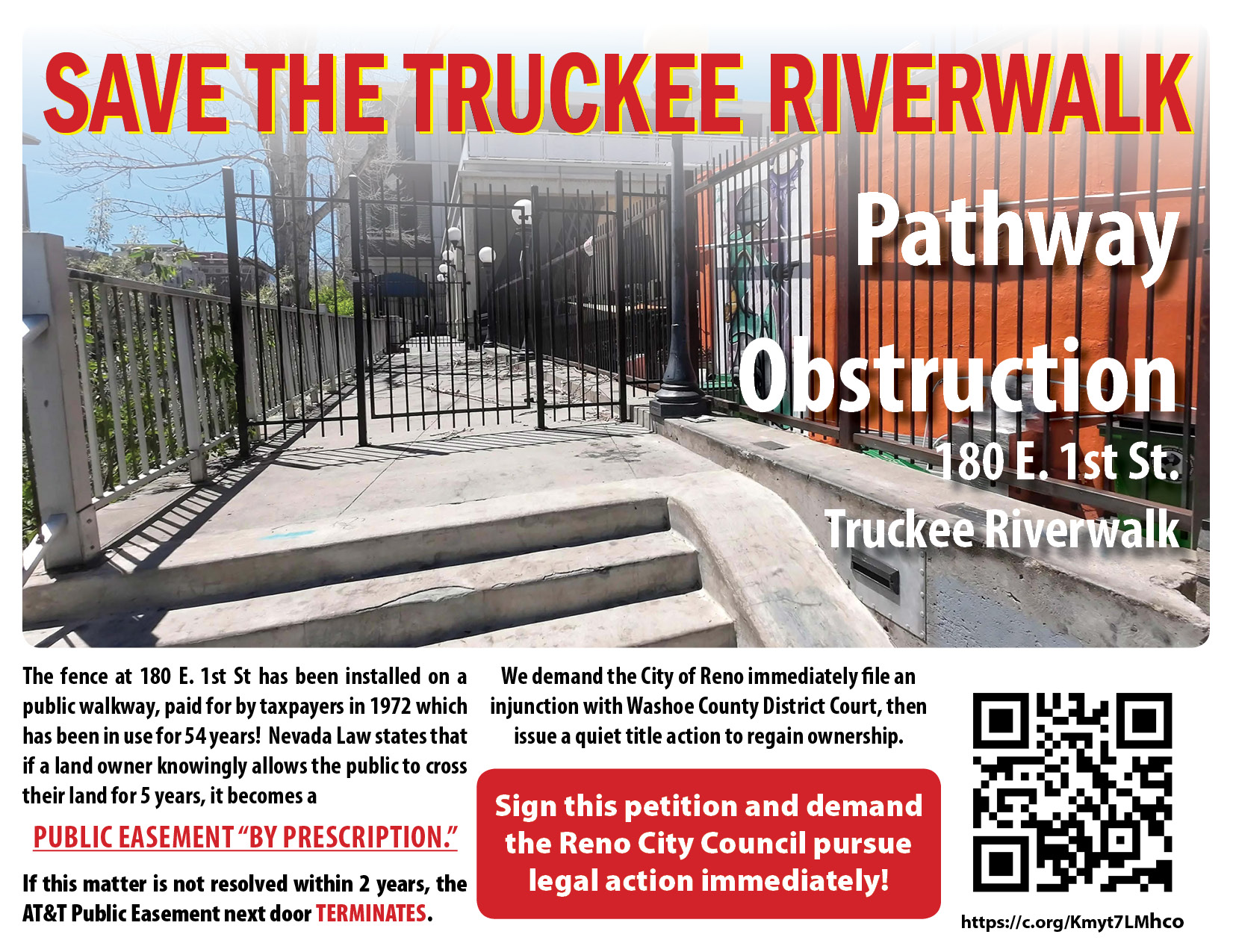
A private gate has illegally severed Reno’s public Truckee Riverwalk and Tahoe-Pyramid Trail system at 180 E. 1st Street. By locking this gate, the property owners have completely blocked a section of the Truckee Riverwalk path, forcing families, pedestrians, and commuters off a dedicated path and onto dangerous downtown streets against traffic on a one-way corridor.
City officials claim they lack the legal authority to reopen the path. Our community's public records completely dismantle this excuse.
Worse, this ongoing obstruction puts our entire riverfront network and federal safety standing in immediate danger. We demand that the City of Reno take swift legal action to assert a public prescriptive easement and clear this gate before our historic public access rights are lost forever, using the unassailable legal trail already in the city's possession:
- The 1972 Cavallo Agreement: Public records prove that on June 12, 1972, the City of Reno entered into a formal contract to construct this concrete retaining wall and walkway at taxpayer expense, explicitly binding all future "successors and assigns." In 1972, $35,941.00 in taxpayer funds were used to construct this improvement to the land, which today would be approximately $287,113.56! The walkway was finished in a record time of 4 months from the time the agreement was reached!
- The 1976 Master Plan Mandate: On May 17, 1976, the Reno City Council officially legislated the Master Plan of Bikeways, incorporating the Truckee River Path as a permanent municipal transport asset and instructing engineers to maintain it as "Bike Route 2." Additionally, RTC has studied this path and conducted an inventory to make improvements and adapt it as a mobility corridor.
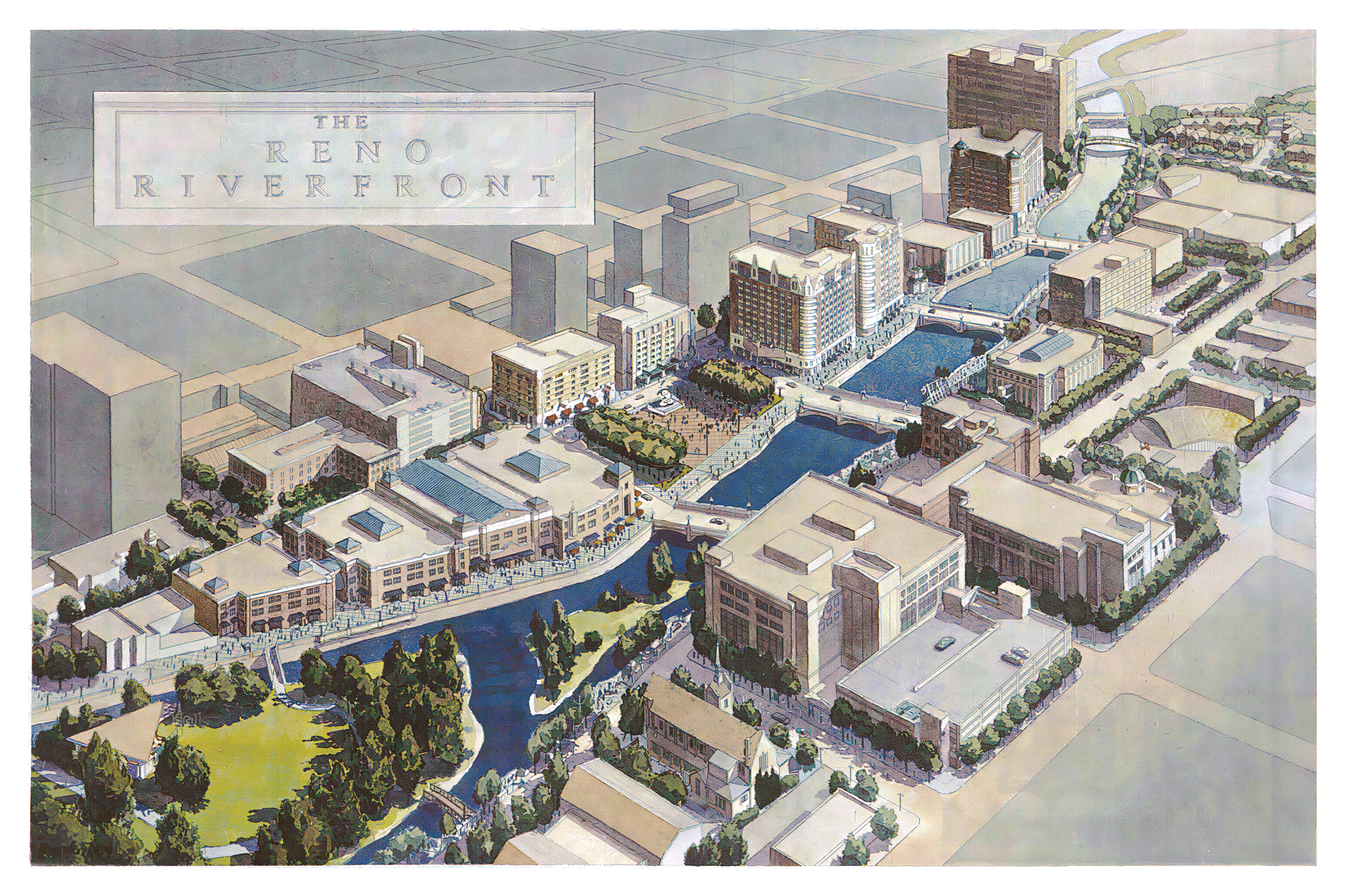
The 1995 Redevelopment Strategy: On March 28, 1995, the Reno Redevelopment Agency Board adopted a strategy legally mandating that this exact urban riverfront frontage "Must Be Active" to ensure continuous public use. Moreover, this walkway is an extremely important link. It was supposed to connect two blocks east, which now leads directly to Greater Nevada Field and Auto Museum by way of a never-completed footbridge! If we lose access to this walkway, the Riverwalk as it was originally envisioned will never be completed. - The 2013 U.S. Army Corps of Engineers GRR (P.L. 109-103): Federal reports prove that the U.S. Army Corps of Engineers has officially defined this flood project as a "single unit and non-separable." (Page S-12). It mandates that local entities must provide and maintain all rights-of-way to secure a $195 million National Flood Insurance Program (NFIP) compliance threshold (Page S-10). Leaving a piece of this corridor blocked directly threatens Reno's federal compliance.
- The 2015 TRFMA Flood Protection Plan: Formally authorized by Congress, this plan targets this exact block for the critical Lake Street Bridge Replacement and floodwall upgrades, mandating that downtown river features "shall maintain public access to the river." When the bridge is completed, the staircase will be removed and become ADA-compliant!
- The 2014 Deed Restrictions (Doc #4367793): The current owners' own property deed explicitly states that their ownership is "SUBJECT TO" all easements, rights of way, covenants, and obligations of record.
- In 2024, the Property Owner Admitted the Walkway Belonged to the City: During an email exchange obtained through Public Records, the property owner demanded the city pay for damages to his fence which remains rusty, ill-maintained and a blight to this day; but after demanding money, now he claims bicycle signage was illegally placed by the Tahoe-Pyramid Trail. This is absolutely false. The City of Reno placed and maintains its MUTCD signage, (which the owner removed), made repairs to the staircase with new cement, and placed decorative lighting along the walkway. The property owner is not acting in good faith. — This PDF also include newspaper clippings of walkway construction history, blueprints, shots from 2011-2025 revealing no signs were ever posted as required by NRS 11.165 to notify public walkway was subject to control of owner, map of Truckee River Path as Urban Bicycle Facility leading to the AT&T / Delluchi walkway and staircase.
- CRITICAL RISK—The 2000 AT&T Easement (Doc #2467231): The public pathway on the adjacent AT&T parcel is bound by a strict clause stating that if the pedestrian walkway goes unused for two years, the public easement automatically terminates. By allowing the gate at 180 E. 1st St. to remain locked, the city is actively running down the clock to permanently destroy neighboring public path easements!
For over 50 years, the public has used this path openly, continuously, and uninterrupted as a dedicated transportation and safety corridor. Under Nevada law, half a century of government-signed public use establishes an absolute public right-of-way that cannot be quietly bargained away.
Allowing private individuals to override their own deed restrictions, threaten adjoining public easements, and violate federal Army Corps project parameters sets a dangerous precedent. We demand that the City of Reno immediately file an injunction with Washoe County District Court, then issue a quiet title action to regain ownership, assert our historic prescriptive easement, and reopen the Truckee Riverwalk at 180 E. 1st Street!
Help share this petition! Click here to download the PDF and print in color or black and white.

30
The Issue
To: The Reno City Council, Mayor Hillary Schieve, Reno City Attorney Karl Hall, and the Truckee River Flood Management Authority (TRFMA)
A private gate has illegally severed Reno’s public Truckee Riverwalk and Tahoe-Pyramid Trail system at 180 E. 1st Street. By locking this gate, the property owners have completely blocked a section of the Truckee Riverwalk path, forcing families, pedestrians, and commuters off a dedicated path and onto dangerous downtown streets against traffic on a one-way corridor.
City officials claim they lack the legal authority to reopen the path. Our community's public records completely dismantle this excuse.
Worse, this ongoing obstruction puts our entire riverfront network and federal safety standing in immediate danger. We demand that the City of Reno take swift legal action to assert a public prescriptive easement and clear this gate before our historic public access rights are lost forever, using the unassailable legal trail already in the city's possession:
- The 1972 Cavallo Agreement: Public records prove that on June 12, 1972, the City of Reno entered into a formal contract to construct this concrete retaining wall and walkway at taxpayer expense, explicitly binding all future "successors and assigns." In 1972, $35,941.00 in taxpayer funds were used to construct this improvement to the land, which today would be approximately $287,113.56! The walkway was finished in a record time of 4 months from the time the agreement was reached!
- The 1976 Master Plan Mandate: On May 17, 1976, the Reno City Council officially legislated the Master Plan of Bikeways, incorporating the Truckee River Path as a permanent municipal transport asset and instructing engineers to maintain it as "Bike Route 2." Additionally, RTC has studied this path and conducted an inventory to make improvements and adapt it as a mobility corridor.
The 1995 Redevelopment Strategy: On March 28, 1995, the Reno Redevelopment Agency Board adopted a strategy legally mandating that this exact urban riverfront frontage "Must Be Active" to ensure continuous public use. Moreover, this walkway is an extremely important link. It was supposed to connect two blocks east, which now leads directly to Greater Nevada Field and Auto Museum by way of a never-completed footbridge! If we lose access to this walkway, the Riverwalk as it was originally envisioned will never be completed. - The 2013 U.S. Army Corps of Engineers GRR (P.L. 109-103): Federal reports prove that the U.S. Army Corps of Engineers has officially defined this flood project as a "single unit and non-separable." (Page S-12). It mandates that local entities must provide and maintain all rights-of-way to secure a $195 million National Flood Insurance Program (NFIP) compliance threshold (Page S-10). Leaving a piece of this corridor blocked directly threatens Reno's federal compliance.
- The 2015 TRFMA Flood Protection Plan: Formally authorized by Congress, this plan targets this exact block for the critical Lake Street Bridge Replacement and floodwall upgrades, mandating that downtown river features "shall maintain public access to the river." When the bridge is completed, the staircase will be removed and become ADA-compliant!
- The 2014 Deed Restrictions (Doc #4367793): The current owners' own property deed explicitly states that their ownership is "SUBJECT TO" all easements, rights of way, covenants, and obligations of record.
- In 2024, the Property Owner Admitted the Walkway Belonged to the City: During an email exchange obtained through Public Records, the property owner demanded the city pay for damages to his fence which remains rusty, ill-maintained and a blight to this day; but after demanding money, now he claims bicycle signage was illegally placed by the Tahoe-Pyramid Trail. This is absolutely false. The City of Reno placed and maintains its MUTCD signage, (which the owner removed), made repairs to the staircase with new cement, and placed decorative lighting along the walkway. The property owner is not acting in good faith. — This PDF also include newspaper clippings of walkway construction history, blueprints, shots from 2011-2025 revealing no signs were ever posted as required by NRS 11.165 to notify public walkway was subject to control of owner, map of Truckee River Path as Urban Bicycle Facility leading to the AT&T / Delluchi walkway and staircase.
- CRITICAL RISK—The 2000 AT&T Easement (Doc #2467231): The public pathway on the adjacent AT&T parcel is bound by a strict clause stating that if the pedestrian walkway goes unused for two years, the public easement automatically terminates. By allowing the gate at 180 E. 1st St. to remain locked, the city is actively running down the clock to permanently destroy neighboring public path easements!
For over 50 years, the public has used this path openly, continuously, and uninterrupted as a dedicated transportation and safety corridor. Under Nevada law, half a century of government-signed public use establishes an absolute public right-of-way that cannot be quietly bargained away.
Allowing private individuals to override their own deed restrictions, threaten adjoining public easements, and violate federal Army Corps project parameters sets a dangerous precedent. We demand that the City of Reno immediately file an injunction with Washoe County District Court, then issue a quiet title action to regain ownership, assert our historic prescriptive easement, and reopen the Truckee Riverwalk at 180 E. 1st Street!
Help share this petition! Click here to download the PDF and print in color or black and white.
The Decision Makers


Petition Updates
Share this petition
Petition created on August 15, 2026