State map shows Florida Panther roadkill in the footprint of proposed development!

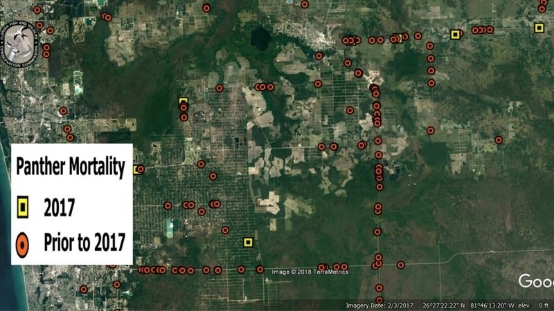
If folks needed more reasons to sign our petition opposing 45,000 acres of new development in panther and other wildlife habitat in Southwest Florida - here are dozens. They're splattered across the same roads where much of the new traffic will go. Map from the Florida Fish and Wildlife Conservation Commission shows Florida Panther roadkill centered on the footprint of the "Habitat Conservation Plan" that is the key to opening this area up to major new developments.
The main concentration of roadkill is SR 29, which runs north-south through the Big Cypress National Preserve and the Florida Panther National Wildlife Refuge. SR 29 connects I-75 (the east-west hotspot for roadkill on this map) to the south and the town of Immokalee to the north. As development fills in this rural area, SR 29 will become one of the main thoroughfares.
And it's not as if the U.S. Fish and Wildlife Service is not aware that roadkill for panthers, bears and other wildlife is going to increase. It's one reason the applicants will be given an "Incidental Take Permit" - so if and when harm does come to an endangered panther or any other federally listed animal as a result of this project, the developers will not be held liable for "take" under the Endangered Species Act.
Map of Florida Black Bear roadkill covering the same area can be found here:
https://drive.google.com/open?id=1mFgWk7lO5UyUvMqB1szCBmMwOoT-pJiQ