Watch those mines on the disused Woodland!

Just a little update to say thank you to everyone that is supporting the campaign! We have over 900 signatures so far! Amazing!!
Hows the week starting?
I started mine with a little nosey through various reports to see what ABVC had been saying about Leafy Lane in the last 5 years.
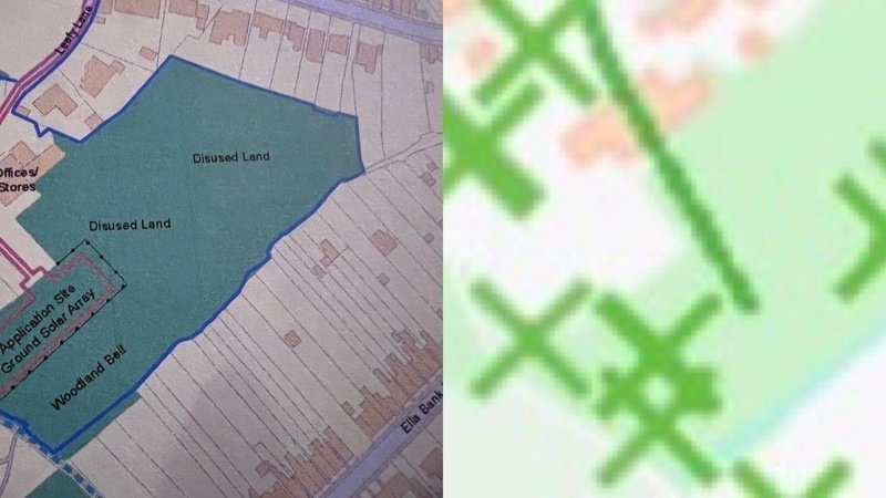
I came across a planning application (now expired) for Solar Panels on Leafy Lane (AVA/2017/0932); on the plan it shows a map with labels that say most of the Woodland is disused land! Yet a very small area next to the proposed area for the Panels was called Woodland.. well unless I am going blind, the Woodland is towards Hands Rd is cetainly alive with trees and wildlife!! It even has that lovely stepped footpath!
I hope the Council do their desktop studies much more in-depth next time!
On another note.. has anyone seen the online Coal Authority website map on its website? Its free to use and shows you known mining activities in the area.
I don’t know much about mining but it was certainly interesting to see all the mine seams and lines all over the Woodland, Depot and Waste land on Leafy Lane.... To be fair, Heanor is known for its historical mining but it certainly had some activity on this land in the last few centuries... I wonder how economically viable that is for a developer..
Anybody else have any interesting info? Comment below would love to hear about it!